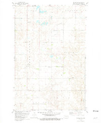
1981 Map of Belden SE
USGS Topo · Published 1981About this map
Crane Creek and West Shell Creek meander across this section of Mountrail County, defining a landscape of prairie drainages and isolated rural infrastructure. The map records a series of distinct local burial grounds, including the Belden Finnish Cem in the north and the Finstad Cem further south, which serve as vital markers of the area's early settlement patterns. Near the center of the township, the Bethlehem Ch and its accompanying Bethlehem Ch Cem stand alongside a local Townhall, representing the social and civic heart of the farming community during this era. The terrain is largely agricultural, punctuated by several Gravel Pit operations and a significant Pipeline corridor that cuts through the southern sections. This survey provides a precise look at the township and range divisions of Sikes, Austin, Wayzetta, and Van Hook.
Find a feature on this map
17 named features on this map. Tap any name to fly to it.
Don’t see what you’re looking for? This feature index may not catch every label — zoom into the map to look around manually.
Map Details
Editions of this 1981 Belden SE Map
This is the sole edition of this map. No revisions or reprints were ever made.
Other maps of this area

1953 · Williston
USGS Topo · 1:250,000

1953 · Watford City
USGS Topo · 1:250,000

1957 · Williston
USGS Topo · 1:250,000

1957 · Watford City
USGS Topo · 1:250,000

1967 · Watford City
USGS Topo · 1:250,000

1981 · Belden SW
USGS Topo · 1:24,000

1981 · New Town
USGS Topo · 1:24,000
1981 · Parshall
USGS Topo · 1:24,000
1981 · Epworth
USGS Topo · 1:24,000
1981 · Epworth NW
USGS Topo · 1:24,000