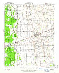
1985 Map of Sikeston
USGS Topo · Published 1986About this map
The Mississippi River dominates this mid-1980s landscape at the convergence of Missouri, Kentucky, Tennessee, and Illinois. The map traces the river's winding path past numerous oxbow features and riverine landmarks like Wolf Island No 5 and Birds Point. Inland, the agricultural grid is defined by the Sikeston Ridge and Big Ridge, where the regional hub of Sikeston and the nearby town of Charleston anchor the transportation network. The drainage patterns of the Missouri Bootheel are clearly visible through features like the Castor River and St Johns Bayou, illustrating how the lowlands were managed for settlement and farming.
Find a feature on this map
166 named features on this map. Tap any name to fly to it.
Don’t see what you’re looking for? This feature index may not catch every label — zoom into the map to look around manually.
Map Details
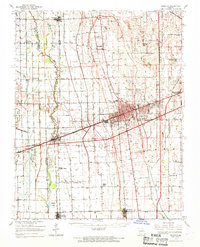
Editions of this 1985 Sikeston Map
2 editions found
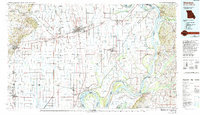
Historical Maps of Sikeston Through Time
5 maps found