
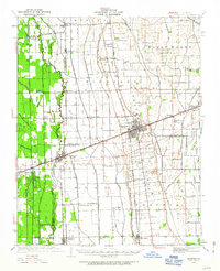
1931 Map of Sikeston
USGS Topo · Published 1931About this map
Sikeston serves as the central hub of this 1930s landscape, where the St Louis - San Francisco and Missouri Pacific railroads intersect. The region is defined by an extensive reclamation network, including Main Ditch, St Johns Ditch, and Town Ditch, which drained the lowlands of Richland and Long Prairie for agriculture. This engineering effort transformed the terrain near Morehouse and Vanduser, supporting a dense network of rural infrastructure.
Find a feature on this map
82 named features on this map. Tap any name to fly to it.
Don’t see what you’re looking for? This feature index may not catch every label — zoom into the map to look around manually.
Map Details
Editions of this 1931 Sikeston Map
2 editions found
Other maps of this area

1934 · Thebes
USGS Topo · 1:62,500

1934 · Morley
USGS Topo · 1:62,500

1934 · Bloomfield
USGS Topo · 1:62,500

1934 · Sikeston
USGS Topo · 1:62,500

1934 · Advance
USGS Topo · 1:62,500

1939 · Bloomfield
USGS Topo · 1:62,500

1939 · Sikeston
USGS Topo · 1:62,500

1939 · Charleston
USGS Topo · 1:62,500

1939 · New Madrid
USGS Topo · 1:62,500

1939 · Morley
USGS Topo · 1:62,500