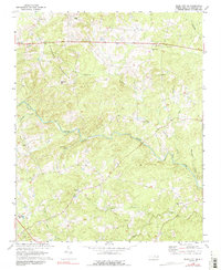
1970 Map of Siler City NE
USGS Topo · Published 1991About this map
Hickory Mountain dominates the northern landscape of this 1970 survey, defining a rural Chatham County topography where small settlements like Landrum and Carolina Hill are spaced between winding river systems. The Rocky River carves a central path through the terrain, joined by numerous tributaries including Tick Creek, Meadow Creek, and Harts Creek. This drainage pattern influenced the placement of the area's many community anchors, particularly its country churches.
Find a feature on this map
23 named features on this map. Tap any name to fly to it.
Don’t see what you’re looking for? This feature index may not catch every label — zoom into the map to look around manually.
Map Details
Editions of this 1970 Siler City NE Map
2 editions found
Other maps of this area

1953 · Raleigh
USGS Topo · 1:250,000

1954 · Raleigh
USGS Topo · 1:250,000

1968 · Bynum
USGS Topo · 1:24,000

1969 · Siler City
USGS Topo · 1:24,000

1970 · Goldston
USGS Topo · 1:24,000

1970 · Pittsboro
USGS Topo · 1:24,000

1970 · Colon
USGS Topo · 1:24,000

1970 · Bear Creek
USGS Topo · 1:24,000

1970 · Siler City NE
USGS Topo · 1:24,000

1974 · Silk Hope
USGS Topo · 1:24,000