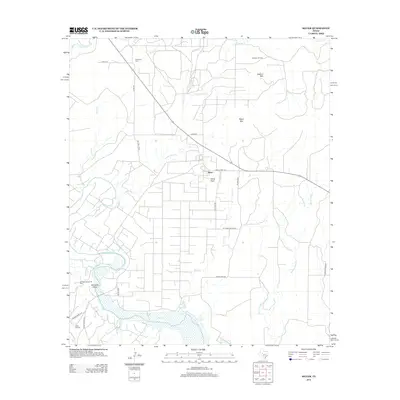
2012 Map of Silver
USGS Topo · Published 2012About this map
The Colorado River defines the southern portion of this landscape, winding through a region characterized by mesas and industrial infrastructure in the early 21st century. The settlement of Silver sits centrally along Ranch Road 1672, flanked by prominent heights such as Silver Peak and Stepp Mtn. This area reflects the region's deep connection to the petroleum industry, with extensive road networks like Silver Loop and Oil Plant Rd serving facilities such as the Pvt Road Gas Plant and the nearby Jameson-Strawn Oil Field.
Find a feature on this map
31 named features on this map. Tap any name to fly to it.
Don’t see what you’re looking for? This feature index may not catch every label — zoom into the map to look around manually.
Map Details
Editions of this 2012 Silver Map
This is the sole edition of this map. No revisions or reprints were ever made.
Other maps of this area

1954 · Big Spring
USGS Topo · 1:250,000

1954 · San Angelo
USGS Topo · 1:250,000

1958 · San Angelo
USGS Topo · 1:250,000

1958 · Big Spring
USGS Topo · 1:250,000

1959 · Pecan Crossing
USGS Topo · 1:24,000

1959 · Dam Draw
USGS Topo · 1:24,000

1959 · Silver
USGS Topo · 1:24,000

1959 · Dead Indian Mountain
USGS Topo · 1:24,000

1962 · Edith
USGS Topo · 1:24,000

1962 · Sanco
USGS Topo · 1:24,000