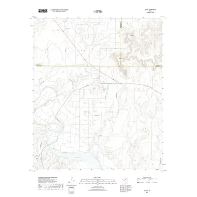
2019 Map of Silver
USGS Topo · Published 2019About this map
Colorado River frontage and the upland plains of Coke County characterize this landscape, where the small community of Silver serves as a central point for local ranching and energy infrastructure. The terrain is marked by distinct mesas and high points such as Silver Peak, Jackson Mtn, and Stepp Mtn, which overlook a network of ephemeral drainages including Willmo Sand Cr and Little Silver Creek. The economic character of the area is evident in the presence of Pvt Rd Gas Plant and Oil Plant Rd, reflecting the regional reliance on natural gas extraction.
Find a feature on this map
32 named features on this map. Tap any name to fly to it.
Don’t see what you’re looking for? This feature index may not catch every label — zoom into the map to look around manually.
Map Details
Editions of this 2019 Silver Map
This is the sole edition of this map. No revisions or reprints were ever made.
Other maps of this area

1954 · Big Spring
USGS Topo · 1:250,000

1954 · San Angelo
USGS Topo · 1:250,000

1958 · San Angelo
USGS Topo · 1:250,000

1958 · Big Spring
USGS Topo · 1:250,000

1959 · Pecan Crossing
USGS Topo · 1:24,000

1959 · Dam Draw
USGS Topo · 1:24,000

1959 · Silver
USGS Topo · 1:24,000

1959 · Dead Indian Mountain
USGS Topo · 1:24,000

1962 · Edith
USGS Topo · 1:24,000

1962 · Sanco
USGS Topo · 1:24,000