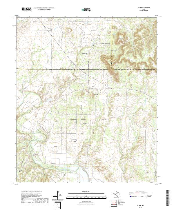
2022 Map of Silver
USGS Topo · Published 2022About this map
Silver lies at the intersection of Coke, Mitchell, and Nolan counties, serving as a focal point for this West Texas landscape defined by the winding course of the Colorado River. The area’s geography is marked by distinctive elevations such as Silver Peak, Stepp Mtn, and Jackson Mtn, which rise above the surrounding plains and drainage systems like Cemetery Draw and Panther Draw. Historically, the presence of Jackson Spring and numerous seasonal creeks including Willmo Sand Cr and Sandy Cr influenced early ranching and settlement patterns in this arid region.
Find a feature on this map
32 named features on this map. Tap any name to fly to it.
Don’t see what you’re looking for? This feature index may not catch every label — zoom into the map to look around manually.
Map Details
Editions of this 2022 Silver Map
This is the sole edition of this map. No revisions or reprints were ever made.
Other maps of this area

1954 · Big Spring
USGS Topo · 1:250,000

1954 · San Angelo
USGS Topo · 1:250,000

1958 · San Angelo
USGS Topo · 1:250,000

1958 · Big Spring
USGS Topo · 1:250,000

1959 · Pecan Crossing
USGS Topo · 1:24,000

1959 · Dam Draw
USGS Topo · 1:24,000

1959 · Silver
USGS Topo · 1:24,000

1959 · Dead Indian Mountain
USGS Topo · 1:24,000

1962 · Edith
USGS Topo · 1:24,000

1962 · Sanco
USGS Topo · 1:24,000