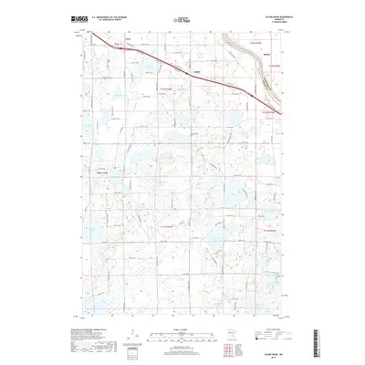
2019 Map of Silver Creek
USGS Topo · Published 2019About this map
The Mississippi River creates a natural boundary in the northeast, separating Sherburne County from Wright County in this landscape defined by glacial depressions and water. The small settlements of Hasty, Enfield, and Becker are connected by major transport routes like County Road 75 NW, which parallels the river's course. Numerous named bodies of water, including the large Maria Lake, Locke Lake, and the cluster near the settlement of Silver Creek, show a dense wetland environment typical of central Minnesota. Local history is anchored at sites like Highland Cemetery near the northern border and Lakeside Cemetery centrally located near West Lake. This 2019 survey documents a region where agricultural land and residential clusters are woven through an extensive network of lakes such as Millstone Lake, Ida Lake, and Lake Mary.
Find a feature on this map
36 named features on this map. Tap any name to fly to it.
Don’t see what you’re looking for? This feature index may not catch every label — zoom into the map to look around manually.
Map Details
Editions of this 2019 Silver Creek Map
This is the sole edition of this map. No revisions or reprints were ever made.
Other maps of this area

1951 · Annandale
USGS Topo · 1:62,500

1953 · Saint Cloud
USGS Topo · 1:250,000

1953 · Stillwater
USGS Topo · 1:250,000

1955 · Stillwater
USGS Topo · 1:250,000

1957 · Saint Cloud
USGS Topo · 1:250,000

1958 · Stillwater
USGS Topo · 1:250,000

1958 · Saint Cloud
USGS Topo · 1:250,000

1958 · Buffalo
USGS Topo · 1:62,500

1958 · Cokato
USGS Topo · 1:62,500

1961 · Clear Lake
USGS Topo · 1:24,000