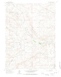
1962 Map of Silver Crown
USGS Topo · Published 1975About this map
Ranching life and water infrastructure define this high-plains landscape west of Cheyenne during the early 1960s. The map reveals a network of family-held land, including the Adolphson Ranch, Old Francis Ranch, and O'Cotner Ranch, situated along the drainages of North Fork Crow Creek and South Fork Crow Creek. A critical feature of this era is the visible path of the Aqueduct and Gilchrist Reservoir, illustrating the vital management of water resources in Laramie County. The presence of the Gilchrist Sch suggests a once-active community node for these distributed homesteads.
Find a feature on this map
23 named features on this map. Tap any name to fly to it.
Don’t see what you’re looking for? This feature index may not catch every label — zoom into the map to look around manually.
Map Details
Editions of this 1962 Silver Crown Map
3 editions found
Other maps of this area

1905 · Sherman
USGS Topo · 1:125,000

1911 · Cheyenne
USGS Topo · 1:125,000

1914 · Cheyenne
USGS Topo · 1:125,000

1950 · Cheyenne
USGS Topo · 1:62,500

1954 · Cheyenne
USGS Topo · 1:250,000

1958 · Cheyenne
USGS Topo · 1:250,000

1961 · Round Top Lake
USGS Topo · 1:24,000
1961 · Borie
USGS Topo · 1:24,000

1961 · Cheyenne
USGS Topo · 1:62,500

1962 · Federal
USGS Topo · 1:24,000