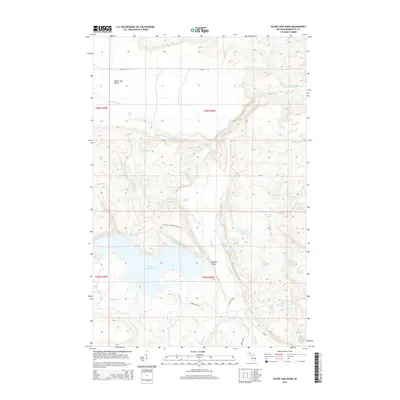
2014 Map of Silver Lake Basin
USGS Topo · Published 2014About this map
Yellow Dog Plains and the adjacent Mulligan Plains dominate this portion of the Upper Peninsula, defining a landscape of high plateaus and sharp river descents. The drainage of the Yellow Dog River is marked by significant topographical shifts, featuring Wylie Falls and Pinnacle Falls as the water moves toward the eastern boundary. To the south, the Silver Lake Basin serves as a major hydrological anchor, surrounded by numerous smaller water bodies such as Silver Lead Mine Lake and the Rocking Chair Lakes.
Find a feature on this map
36 named features on this map. Tap any name to fly to it.
Don’t see what you’re looking for? This feature index may not catch every label — zoom into the map to look around manually.
Map Details
Editions of this 2014 Silver Lake Basin Map
This is the sole edition of this map. No revisions or reprints were ever made.
Other maps of this area

1954 · Negaunee SW
USGS Topo · 1:24,000

1954 · Negaunee
USGS Topo · 1:62,500

1954 · Huron Mountain
USGS Topo · 1:62,500

1954 · Big Bay
USGS Topo · 1:62,500

1955 · Champion
USGS Topo · 1:24,000

1955 · Diorite
USGS Topo · 1:24,000

1955 · Champion
USGS Topo · 1:62,500

1958 · Marquette
USGS Topo · 1:250,000

1960 · Marquette
USGS Topo · 1:250,000

1961 · Marquette
USGS Topo · 1:250,000