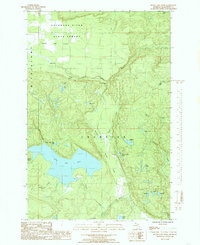
1985 Map of Silver Lake Basin
USGS Topo · Published 1985About this map
Escanaba River State Forest covers the northern reaches of this Upper Peninsula landscape, where the Yellow Dog Plains give way to a dense network of watercourses and elevation changes. The hydrology of the region is defined by the Yellow Dog River and its numerous tributaries, including Yellow Dog Creek and Mulligan Creek. Significant natural landmarks like Pinnacle Falls and Wylie Falls underscore the varied relief of the terrain.
Find a feature on this map
33 named features on this map. Tap any name to fly to it.
Don’t see what you’re looking for? This feature index may not catch every label — zoom into the map to look around manually.
Map Details
Editions of this 1985 Silver Lake Basin Map
This is the sole edition of this map. No revisions or reprints were ever made.
Other maps of this area

1954 · Negaunee SW
USGS Topo · 1:24,000

1954 · Negaunee
USGS Topo · 1:62,500

1954 · Huron Mountain
USGS Topo · 1:62,500

1954 · Big Bay
USGS Topo · 1:62,500

1955 · Champion
USGS Topo · 1:24,000

1955 · Diorite
USGS Topo · 1:24,000

1955 · Champion
USGS Topo · 1:62,500

1958 · Marquette
USGS Topo · 1:250,000

1960 · Marquette
USGS Topo · 1:250,000

1961 · Marquette
USGS Topo · 1:250,000