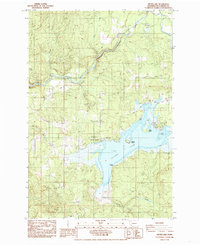
1985 Map of Silver Lake
USGS Topo · Published 1985About this map
The Toutle River carves a dramatic path through the northern portion of this quadrangle, passing through the steep Hollywood Gorge before winding past Tower Cemetery. To the south, the expansive waters of Silver Lake dominate the landscape, featuring prominent landforms such as Goat Island, Indian Island, and Timber Point. This area represents a crossroads of recreation and resource extraction in the mid-1980s, where the protected grounds of Seaquest State Park sit adjacent to industrial sites like a Quarry and Borrow Pit.
Find a feature on this map
24 named features on this map. Tap any name to fly to it.
Don’t see what you’re looking for? This feature index may not catch every label — zoom into the map to look around manually.
Map Details
Editions of this 1985 Silver Lake Map
2 editions found
Other maps of this area

1921 · Kalama
USGS Topo · 1:62,500

1941 · Olequa
USGS Topo · 1:62,500

1942 · Toutle
USGS Topo · 1:62,500

1943 · Pigeon Springs
USGS Topo · 1:62,500

1953 · Hoquiam
USGS Topo · 1:250,000

1953 · Toutle
USGS Topo · 1:62,500

1953 · Castle Rock
USGS Topo · 1:62,500

1953 · Mt. Brynion
USGS Topo · 1:24,000

1953 · Pigeon Springs
USGS Topo · 1:62,500
1953 · Kelso
USGS Topo · 1:24,000