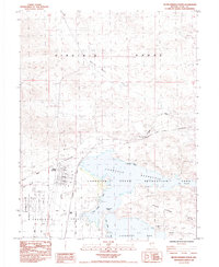
1985 Map of Silver Springs North
USGS Topo · Published 1985About this map
Silver Springs stands as the primary settlement on this Lyon County survey, positioned at the edge of the Churchill Valley and the vast Lahontan State Recreation Area. The map documents a convergence of historic and modern transport, where the California Emigrant Trail (Carson River Route) crosses paths with the Southern Pacific railroad and the Lahontan Airstrip. Significant historical markers include Hawes Station (Site) and scattered Ruins in the foothills, suggesting the remnants of earlier pioneer and mining activity. The terrain is defined by the stark transition from the Virginia Range and White Sage Flat in the north to the expanding shoreline of the Lahontan Reservoir, featuring recreation hubs like Virginia Beach and Fishermans Point. Numerous mining prospects and gravel pits throughout the hills indicate the area's continued mineral interest into the late 20th century.
Find a feature on this map
30 named features on this map. Tap any name to fly to it.
Don’t see what you’re looking for? This feature index may not catch every label — zoom into the map to look around manually.
Map Details
Editions of this 1985 Silver Springs North Map
2 editions found
Other maps of this area

1890 · Wadsworth
USGS Topo · 1:125,000

1891 · Wabuska
USGS Topo · 1:125,000

1892 · Wadsworth
USGS Topo · 1:125,000

1894 · Wadsworth
USGS Topo · 1:125,000

1894 · Wabuska
USGS Topo · 1:125,000

1957 · Churchill Butte
USGS Topo · 1:62,500

1957 · Two Tips
USGS Topo · 1:62,500

1957 · Wadsworth
USGS Topo · 1:62,500

1957 · Silver Springs
USGS Topo · 1:62,500

1957 · Reno
USGS Topo · 1:250,000