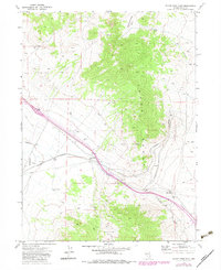
1971 Map of Silver Zone Pass
USGS Topo · Published 1983About this map
The Toana Range dominates this Great Basin landscape, serving as a backdrop for vital transportation and utility corridors in Elko County. The Western Pacific railroad navigates the complex terrain of Silver Zone Pass, including the distinctive engineering of The Loop near the settlement of Cliffside. This high-desert region is defined by its water management and industrial infrastructure, from the Aqueduct traversing the basin to numerous Borrow Pits and a Mine located along the eastern slopes.
Find a feature on this map
21 named features on this map. Tap any name to fly to it.
Don’t see what you’re looking for? This feature index may not catch every label — zoom into the map to look around manually.
Map Details
Editions of this 1971 Silver Zone Pass Map
2 editions found
Other maps of this area

1955 · Wells
USGS Topo · 1:250,000

1955 · Elko
USGS Topo · 1:250,000

1958 · Wells
USGS Topo · 1:250,000

1958 · Elko
USGS Topo · 1:250,000

1961 · Wells
USGS Topo · 1:250,000

1962 · Elko
USGS Topo · 1:250,000

1965 · Elko
USGS Topo · 1:250,000
1967 · Pilot Peak SW
USGS Topo · 1:24,000

1967 · Cobre SE
USGS Topo · 1:24,000

1967 · Cobre
USGS Topo · 1:24,000