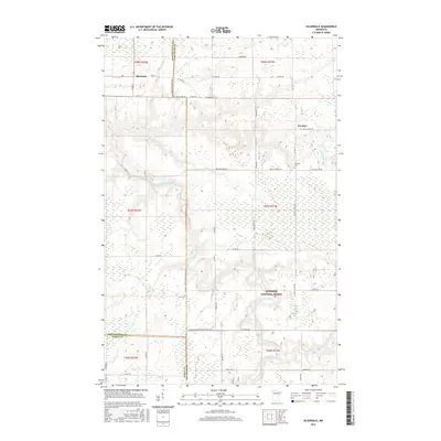
2016 Map of Silverdale
USGS Topo · Published 2016About this map
Silverdale and Greaney anchor this northern Minnesota landscape where three counties—St Louis, Koochiching, and Itasca—converge. The settlement at Greaney is home to the Greaney Cem, while the town of Silverdale sits near the intersection of Co Rd 74 and Co Rd 151. The terrain is defined by a dense network of water, with the Little Fork River winding through the center and the Sturgeon River cutting across the southern reaches. A portion of the Superior National Forest dominates the southeastern quadrant, illustrating the region's heavily forested character. The map traces local travel routes like the St Louis - Koochiching Judicial Rd and family-named ways such as Polich Rd, Nelson Rd, and W Olson Rd, reflecting the rural infrastructure established for the timber and agricultural communities of the mid-2010s.
Find a feature on this map
41 named features on this map. Tap any name to fly to it.
Don’t see what you’re looking for? This feature index may not catch every label — zoom into the map to look around manually.
Map Details
Editions of this 2016 Silverdale Map
This is the sole edition of this map. No revisions or reprints were ever made.
Other maps of this area

1954 · Hibbing
USGS Topo · 1:250,000

1954 · International Falls
USGS Topo · 1:250,000

1957 · Hibbing
USGS Topo · 1:250,000

1957 · International Falls
USGS Topo · 1:250,000

1958 · International Falls
USGS Topo · 1:250,000

1958 · Hibbing
USGS Topo · 1:250,000

1964 · Hibbing
USGS Topo · 1:250,000

1964 · Gheen NW
USGS Topo · 1:24,000
1964 · Meadow Brook
USGS Topo · 1:24,000

1968 · Orr SW
USGS Topo · 1:24,000