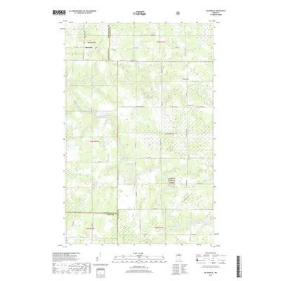
2019 Map of Silverdale
USGS Topo · Published 2019About this map
Silverdale and Greaney anchor this portion of Northern Minnesota, where the forest gives way to a complex system of winding waterways. The landscape is defined by the meanders of the Little Fork River and the Sturgeon River, which thread through the southern reaches, while the Willow River and Bois Forte Cr drain the northern sections. This area sits at a significant political junction where the boundaries of Koochiching, Itasca, and St. Louis counties converge. The presence of the Superior National Forest in the southeast quadrant highlights the heavily timbered nature of the terrain. Local history and genealogy interest is centered around the Greaney Cemetery, located just south of its namesake settlement along St. Louis Co Rd 503. The road network, including Industrial Ave and Co Hwy 74, reflects the rural infrastructure of this timber and river-heavy region.
Find a feature on this map
40 named features on this map. Tap any name to fly to it.
Don’t see what you’re looking for? This feature index may not catch every label — zoom into the map to look around manually.
Map Details
Editions of this 2019 Silverdale Map
This is the sole edition of this map. No revisions or reprints were ever made.
Other maps of this area

1954 · Hibbing
USGS Topo · 1:250,000

1954 · International Falls
USGS Topo · 1:250,000

1957 · Hibbing
USGS Topo · 1:250,000

1957 · International Falls
USGS Topo · 1:250,000

1958 · International Falls
USGS Topo · 1:250,000

1958 · Hibbing
USGS Topo · 1:250,000

1964 · Hibbing
USGS Topo · 1:250,000

1964 · Gheen NW
USGS Topo · 1:24,000
1964 · Meadow Brook
USGS Topo · 1:24,000

1968 · Orr SW
USGS Topo · 1:24,000