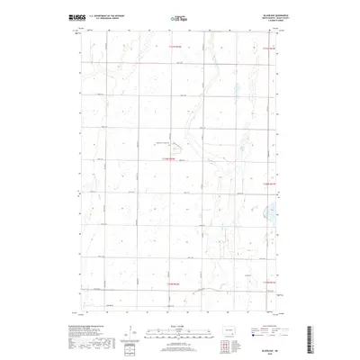
2018 Map of Silverleaf
USGS Topo · Published 2018About this map
Silverleaf anchors the southeastern corner of this Dickey County landscape, where the prairie is defined by the winding course of the Maple River. This 2018 survey reveals a terrain of low relief punctuated by numerous small depressions and the broader basin of Maple River Lake. The rural layout is strictly organized by a section-line road grid, including Dickey Cty 5 and the aptly named Cemetery Rd. North of the river, the Maple River Colony Cem stands as a significant genealogical marker near the junction of 93rd Ave SE. The presence of Dry Br in the west suggests the seasonal hydrology typical of the North Dakota plains, where water is a precious and shifting element of the agrarian environment.
Find a feature on this map
28 named features on this map. Tap any name to fly to it.
Don’t see what you’re looking for? This feature index may not catch every label — zoom into the map to look around manually.
Map Details
Editions of this 2018 Silverleaf Map
This is the sole edition of this map. No revisions or reprints were ever made.
Other maps of this area

1894 · Monango
USGS Topo · 1:62,500

1894 · Ellendale
USGS Topo · 1:62,500

1894 · Savo
USGS Topo · 1:62,500

1894 · Fullerton
USGS Topo · 1:62,500

1895 · Lamoure
USGS Topo · 1:125,000

1896 · Columbia
USGS Topo · 1:125,000

1896 · Edgeley
USGS Topo · 1:125,000

1899 · Ellendale
USGS Topo · 1:125,000

1918 · La Moure
USGS Topo · 1:125,000

1925 · Edgeley
USGS Topo · 1:125,000