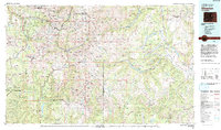
1982 Map of Silverton
USGS Topo · Published 1992About this map
Silverton and Telluride serve as the primary hubs in this high-altitude landscape dominated by the San Juan Mountains. The map illustrates a region defined by its industrial heritage and challenging geography, tracing the Denver and Rio Grande Western RR as it navigates narrow valleys. Mining operations such as the Sunnyside Mine, Camp Bird Mine, and Old Hundred Mine are situated near remote settlements like Animas Forks and Eureka, reflecting a century of hard-rock extraction.
Find a feature on this map
73 named features on this map. Tap any name to fly to it.
Don’t see what you’re looking for? This feature index may not catch every label — zoom into the map to look around manually.
Map Details
Editions of this 1982 Silverton Map
3 editions found
Other maps of this area

1895 · La Plata
USGS Topo · 1:62,500

1897 · La Plata
USGS Topo · 1:62,500

1897 · Rico
USGS Topo · 1:62,500

1897 · Telluride
USGS Topo · 1:62,500

1897 · Silverton
USGS Topo · 1:62,500

1898 · Durango
USGS Topo · 1:62,500

1898 · Engineer Mountain
USGS Topo · 1:62,500

1898 · Rico
USGS Topo · 1:62,500

1899 · La Plata
USGS Topo · 1:62,500

1899 · Rico
USGS Topo · 1:62,500