
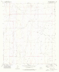
1970 Map of Simanola Valley
USGS Topo · Published 1972About this map
Simanola Valley characterizes this high plains landscape of Lea County, where the 1970 topography reveals an environment defined by ranching infrastructure and mineral extraction. The map captures a vital network of family and pasture-named water sources, including the Ninemile Windmill, Badger Windmill, and Shipper Pen Windmill, which were essential for cattle in this arid terrain. Near the Jones Ranch, the land transitions into the industrial footprint of the Ranger Lake Oil Field, marked by numerous drill holes and a significant Pipeline cutting across the southeastern quadrant.
Find a feature on this map
29 named features on this map. Tap any name to fly to it.
Don’t see what you’re looking for? This feature index may not catch every label — zoom into the map to look around manually.
Map Details
Editions of this 1970 Simanola Valley Map
This is the sole edition of this map. No revisions or reprints were ever made.
Other maps of this area

1954 · Brownfield
USGS Topo · 1:250,000

1958 · Brownfield
USGS Topo · 1:250,000

1961 · Johnson Ranch
USGS Topo · 1:24,000

1962 · Brownfield
USGS Topo · 1:250,000

1970 · Johnson Ranch
USGS Topo · 1:24,000

1970 · Tatum South
USGS Topo · 1:24,000

1970 · Alston Ranch
USGS Topo · 1:24,000

1970 · Ranger Lake
USGS Topo · 1:24,000

1970 · Tatum North
USGS Topo · 1:24,000
1973 · Frier Ranch
USGS Topo · 1:24,000