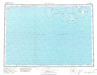
1963 Map of Simeonof Island
USGS Topo · Published 1981About this map
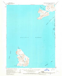
The Shumagin Islands archipelago rises from the North Pacific in this survey, showcasing the remote maritime geography of the Aleutian chain in the early 1960s. Central to the sheet is the Simeonof Nat Wildlife Mfg, encompassing the entirety of Simeonof Island, which features the sheltered waters of Simeonof Hbr and the nearby Murie Islets. The map illustrates the hazardous coastal navigation of the era, marking landforms like Saddlers Mistake and Point Farewell alongside the depths of Twelve Fathom Strait. To the west, the rugged profile of Nagai Island is defined by Sadler Peak and Mountain Point, while Chernabura Island stands as a prominent outpost to the south. This charting was compiled from both 1:63,360 scale topographic surveys and hydrographic data, capturing the intersection of island terrain and the submerged Shumagin Bank.
Find a feature on this map
22 named features on this map. Tap any name to fly to it.
Don’t see what you’re looking for? This feature index may not catch every label — zoom into the map to look around manually.
Map Details
Editions of this 1963 Simeonof Island Map
3 editions found

Other maps of this area

1949 · False Pass
USGS Topo · 1:250,000

1950 · False Pass
USGS Topo · 1:250,000

1951 · Stepovak Bay
USGS Topo · 1:250,000

1953 · Port Moller
USGS Topo · 1:250,000

1963 · Port Moller A-5
USGS Topo · 1:63,360
1963 · Port Moller A-4
USGS Topo · 1:63,360

1963 · Port Moller A-1
USGS Topo · 1:63,360

1963 · Port Moller A-2
USGS Topo · 1:63,360
1963 · False Pass D-0
USGS Topo · 1:63,360
1963 · Simeonof Island D-2
USGS Topo · 1:63,360