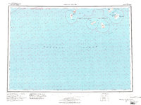
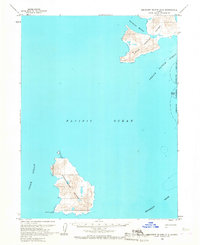
1963 Map of Simeonof Island
USGS Topo · Published 1981About this map
Simeonof Nat Wildlife Rfg dominates the eastern reach of this coastal survey, encompassing the sanctuary waters surrounding Simeonof Island and the Murie Islets. The map illustrates a remote maritime environment within the Shumagin Islands, where landmasses like Nagai Island and Chernabura Island are defined by sharp coastal features such as Saddlers Mistake and Point Farewell. Navigation and hydrography are central themes, with soundings and seafloor data covering the Shumagin Bank and passages like Twelve Fathom Strait and Otter Strait. The interior of the larger islands is characterized by high points like Mountain Point, while the coastline is dotted with isolated anchorages including Simeonof Hbr and Northeast Harbor. This maritime record focuses on the relationship between the Pacific Ocean and these isolated outposts of the Aleutian chain, captured during a period of active offshore protraction and hydrographic study.
Find a feature on this map
21 named features on this map. Tap any name to fly to it.
Don’t see what you’re looking for? This feature index may not catch every label — zoom into the map to look around manually.
Map Details
Editions of this 1963 Simeonof Island Map
3 editions found

Other maps of this area

1949 · False Pass
USGS Topo · 1:250,000

1950 · False Pass
USGS Topo · 1:250,000

1951 · Stepovak Bay
USGS Topo · 1:250,000

1953 · Port Moller
USGS Topo · 1:250,000

1963 · Port Moller A-5
USGS Topo · 1:63,360
1963 · Port Moller A-4
USGS Topo · 1:63,360

1963 · Port Moller A-1
USGS Topo · 1:63,360

1963 · Port Moller A-2
USGS Topo · 1:63,360
1963 · False Pass D-0
USGS Topo · 1:63,360
1963 · Simeonof Island D-2
USGS Topo · 1:63,360