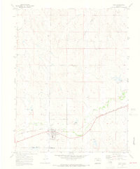
1970 Map of Simla
USGS Topo · Published 1973About this map
Simla serves as the primary hub of this eastern Colorado landscape, situated along the southern edge of the quadrangle where the Chicago Rock Island and Pacific railroad tracks follow the natural corridor of Sandy Creek. The town's civic layout is well-defined, featuring the Big Sandy Sch, an adjacent Athletic Field, and the Big Sandy Sch Water Tanks. Local genealogy and land history are anchored by the Cem located just north of the residential blocks.
Find a feature on this map
13 named features on this map. Tap any name to fly to it.
Don’t see what you’re looking for? This feature index may not catch every label — zoom into the map to look around manually.
Map Details
Editions of this 1970 Simla Map
4 editions found

Other maps of this area

1891 · Limon
USGS Topo · 1:125,000

1892 · Limon
USGS Topo · 1:125,000

1953 · Denver
USGS Topo · 1:250,000

1954 · Limon
USGS Topo · 1:250,000

1957 · Denver
USGS Topo · 1:250,000

1957 · Limon
USGS Topo · 1:250,000

1958 · Limon
USGS Topo · 1:250,000

1958 · Denver
USGS Topo · 1:250,000

1960 · Denver
USGS Topo · 1:250,000
1970 · Matheson SW
USGS Topo · 1:24,000