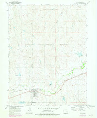
1970 Map of Simla
USGS Topo · Published 1979About this map
The town of Simla serves as the focal point of this high plains landscape, situated along the Chicago Rock Island and Pacific railroad line. This survey, updated with revisions through the late 1970s, illustrates a community organized around its transportation and agricultural infrastructure. The residential core near Washington Ave is flanked by local landmarks such as the Big Sandy Sch and a municipal Athletic Field, while the town's cemetery Cem lies just to the north.
Find a feature on this map
23 named features on this map. Tap any name to fly to it.
Don’t see what you’re looking for? This feature index may not catch every label — zoom into the map to look around manually.
Map Details
Editions of this 1970 Simla Map
4 editions found

Other maps of this area

1891 · Limon
USGS Topo · 1:125,000

1892 · Limon
USGS Topo · 1:125,000

1953 · Denver
USGS Topo · 1:250,000

1954 · Limon
USGS Topo · 1:250,000

1957 · Denver
USGS Topo · 1:250,000

1957 · Limon
USGS Topo · 1:250,000

1958 · Limon
USGS Topo · 1:250,000

1958 · Denver
USGS Topo · 1:250,000

1960 · Denver
USGS Topo · 1:250,000
1970 · Matheson SW
USGS Topo · 1:24,000