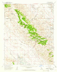
1959 Map of Simmler
USGS Topo · Published 1961About this map
The Temblor Range divides the landscape into two distinct industrial and ecological zones at the boundary of Kern and San Luis Obispo counties. To the west lies the broad, arid expanse of the Carrizo Plain, characterized by the massive alkali basin of Soda Lake and the small settlement of Simmler with its Community Hall. This area is marked by ranching outposts like Las Yeguas Ranch and Ross Ranch, while the Goodwin Ranch Airport provides a remote point of access.
Find a feature on this map
37 named features on this map. Tap any name to fly to it.
Don’t see what you’re looking for? This feature index may not catch every label — zoom into the map to look around manually.
Map Details
Editions of this 1959 Simmler Map
2 editions found
Other maps of this area

1912 · McKittrick
USGS Topo · 1:125,000

1914 · Lost Hills
USGS Topo · 1:125,000

1914 · Cholame
USGS Topo · 1:125,000

1915 · Cholame
USGS Topo · 1:125,000

1917 · Cholame
USGS Topo · 1:125,000

1932 · West of Goose Lake
USGS Topo · 1:31,680

1932 · La Panza
USGS Topo · 1:48,000

1934 · West of Goose Lake
USGS Topo · 1:31,680

1935 · La Panza
USGS Topo · 1:62,500

1936 · La Panza
USGS Topo · 1:62,500