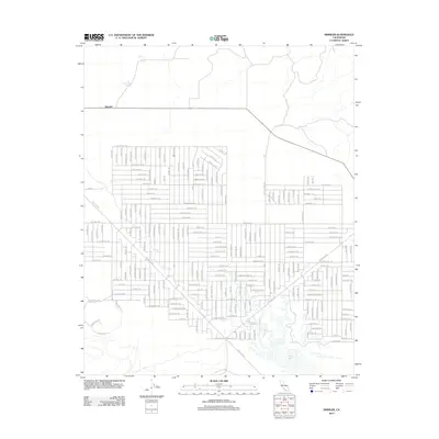
2012 Map of Simmler
USGS Topo · Published 2012About this map
Soda Lake dominates the southern landscape of this 2012 survey, its ephemeral basin providing a stark contrast to the organized grid of the surrounding Carrizo Plain. The small settlement of Simmler sits at the intersection of local routes, serving as a rare anchor point in this arid terrain. A massive, complex network of planned roads and trails creates an intriguing geometric pattern across the valley floor, with names like Death Valley Rd, Clear Lake Rd, and Cloverdale Trl suggesting a large-scale land subdivision or ranching development. This infrastructure, largely unpaved, reflects a unique era of rural planning where hundreds of named thoroughfares were laid out despite the sparse population. To the north, Thompson Spring offers a rare named water source, indicating the historical importance of such features for survival and settlement in this corner of Kern County.
Find a feature on this map
223 named features on this map. Tap any name to fly to it.
Don’t see what you’re looking for? This feature index may not catch every label — zoom into the map to look around manually.
Map Details
Editions of this 2012 Simmler Map
This is the sole edition of this map. No revisions or reprints were ever made.
Other maps of this area

1912 · McKittrick
USGS Topo · 1:125,000

1932 · La Panza
USGS Topo · 1:48,000

1935 · La Panza
USGS Topo · 1:62,500

1936 · La Panza
USGS Topo · 1:62,500

1937 · Branch Mtn
USGS Topo · 1:48,000

1941 · Caliente Mountain
USGS Topo · 1:62,500

1942 · Branch Mountain
USGS Topo · 1:62,500

1942 · Caliente Mtn
USGS Topo · 1:62,500

1943 · Simmler
USGS Topo · 1:62,500

1943 · Caliente Mtn.
USGS Topo · 1:62,500