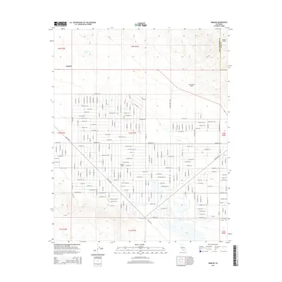
2015 Map of Simmler
USGS Topo · Published 2015About this map
The San Andreas Fault cuts a diagonal line across this portion of the Carrizo Plain, marking the geological divide between the flat valley floor and the rising heights of the Temblor Range. This arid landscape is centered on the small settlement of Simmler, where a dense grid of named trails and roads like Belmont Trl and Clements Trl crisscross the basin. To the south, the terrain descends toward the seasonal basin of Soda Lake, a prominent endorheic feature that dominates the local hydrology.
Find a feature on this map
83 named features on this map. Tap any name to fly to it.
Don’t see what you’re looking for? This feature index may not catch every label — zoom into the map to look around manually.
Map Details
Editions of this 2015 Simmler Map
This is the sole edition of this map. No revisions or reprints were ever made.
Other maps of this area

1912 · McKittrick
USGS Topo · 1:125,000

1932 · La Panza
USGS Topo · 1:48,000

1935 · La Panza
USGS Topo · 1:62,500

1936 · La Panza
USGS Topo · 1:62,500

1937 · Branch Mtn
USGS Topo · 1:48,000

1941 · Caliente Mountain
USGS Topo · 1:62,500

1942 · Branch Mountain
USGS Topo · 1:62,500

1942 · Caliente Mtn
USGS Topo · 1:62,500

1943 · Simmler
USGS Topo · 1:62,500

1943 · Caliente Mtn.
USGS Topo · 1:62,500