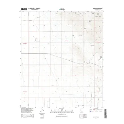
2014 Map of Simmons Peak
USGS Topo · Published 2014About this map
The Dos Cabezas Mountains dominate this high-desert terrain in Cochise County, rising to summits like Simmons Peak and Silver Peak. The landscape is etched by a complex drainage system, including Mescal Canyon, Boulder Canyon, and Malay Canyon, while named points of interest such as Silver Camp Divide and California Gulch suggest a history of prospecting and mineral exploration. Water sources are critical markers in this environment, with several identified springs including Muskhog Spring, Speaks Spring, and Apache Spring. To the south and west, the terrain levels into ranchlands and rural tracts accessed by a network of local roads such as S Martin Ranch Rd and E Moore Ranch Rd. This 2014 survey documents the modern intersection of private property lines and public land, where named tracks like S Butterfield Rd and Hacienda Trl navigate the base of the mountains along the Az-186 corridor.
Find a feature on this map
51 named features on this map. Tap any name to fly to it.
Don’t see what you’re looking for? This feature index may not catch every label — zoom into the map to look around manually.
Map Details
Editions of this 2014 Simmons Peak Map
This is the sole edition of this map. No revisions or reprints were ever made.
Other maps of this area

1922 · Willcox
USGS Topo · 1:125,000

1943 · Dos Cabezas
USGS Topo · 1:62,500

1943 · Willcox
USGS Topo · 1:62,500

1943 · Cochise
USGS Topo · 1:62,500

1944 · Fisher Hills
USGS Topo · 1:62,500

1954 · Silver City
USGS Topo · 1:250,000

1957 · Dos Cabezas
USGS Topo · 1:62,500

1957 · Luzena
USGS Topo · 1:62,500

1958 · Silver City
USGS Topo · 1:250,000

1958 · Willcox
USGS Topo · 1:62,500