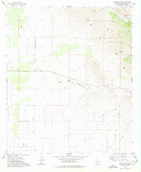
1978 Map of Simmons Peak
USGS Topo · Published 1978About this map
The Dos Cabezas Mountains dominate this high-desert landscape in Cochise County, rising to peaks like Silver Peak and Simmons Peak. The map reveals a network of canyons and gulches, including California Gulch and Mescal Canyon, that define the rugged drainage patterns of the range. Resource extraction and cattle ranching leave their mark on the terrain through features like a Prospect and several Gravel Pit locations, alongside scattered Well sites and a livestock Corral.
Find a feature on this map
27 named features on this map. Tap any name to fly to it.
Don’t see what you’re looking for? This feature index may not catch every label — zoom into the map to look around manually.
Map Details
Editions of this 1978 Simmons Peak Map
This is the sole edition of this map. No revisions or reprints were ever made.
Other maps of this area

1922 · Willcox
USGS Topo · 1:125,000

1943 · Dos Cabezas
USGS Topo · 1:62,500

1943 · Willcox
USGS Topo · 1:62,500

1943 · Cochise
USGS Topo · 1:62,500

1944 · Fisher Hills
USGS Topo · 1:62,500

1954 · Silver City
USGS Topo · 1:250,000

1957 · Dos Cabezas
USGS Topo · 1:62,500

1957 · Luzena
USGS Topo · 1:62,500

1958 · Silver City
USGS Topo · 1:250,000

1958 · Willcox
USGS Topo · 1:62,500