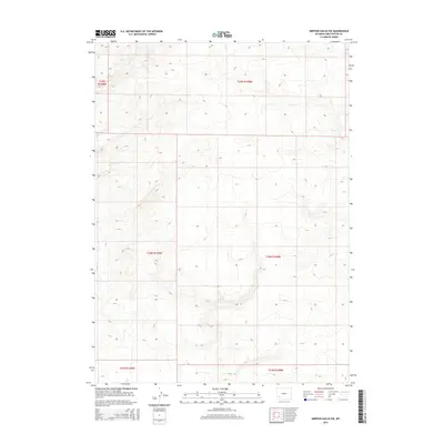
2015 Map of Simpson Gulch SW
USGS Topo · Published 2015About this map
Sweetwater County's high desert landscape is defined by the Public Land Survey System grid in this recent topographical study. The map area is primarily partitioned by the boundaries of T25n R108w and T24n R108w, revealing a terrain shaped by gradual elevation changes and drainage patterns typical of the Wyoming basin. This document captures the modern state of the land as of 2015, showing the intersection of several townships including T25n R109w and T23n R109w. Researchers can use the detailed contour lines and section markers to study the local topography and the precise land divisions that govern this section of the state.
Find a feature on this map
6 named features on this map. Tap any name to fly to it.
Don’t see what you’re looking for? This feature index may not catch every label — zoom into the map to look around manually.
Map Details
Editions of this 2015 Simpson Gulch SW Map
This is the sole edition of this map. No revisions or reprints were ever made.
Other maps of this area

1954 · Rock Springs
USGS Topo · 1:250,000

1955 · Lander
USGS Topo · 1:250,000

1958 · Lander
USGS Topo · 1:250,000

1958 · Rock Springs
USGS Topo · 1:250,000

1961 · Lander
USGS Topo · 1:250,000

1962 · Rock Springs
USGS Topo · 1:250,000

1963 · Gasson Bridge
USGS Topo · 1:24,000

1963 · Pittman Well
USGS Topo · 1:24,000
1963 · Thoman School
USGS Topo · 1:24,000
1968 · Twelvemile Sink
USGS Topo · 1:24,000