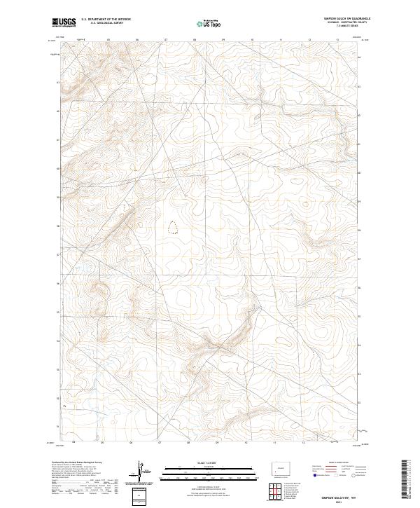
2021 Map of Simpson Gulch SW
USGS Topo · Published 2021About this map
Township boundaries and the vast expanses of the Wyoming landscape define this 2021 survey in Sweetwater County. The map is primarily characterized by its legal land partitions, including the intersection of t24n r109w and t24n r108w. While the labels focus on the Public Land Survey System rather than specific settlements or named structures, the intricate contour lines illustrate a region of significant elevation changes and complex drainage patterns. This study provides a precise contemporary look at the topographical layout of the area, serving as a foundational record for land management and regional geography in the modern era.
Find a feature on this map
6 named features on this map. Tap any name to fly to it.
Don’t see what you’re looking for? This feature index may not catch every label — zoom into the map to look around manually.
Map Details
Editions of this 2021 Simpson Gulch SW Map
This is the sole edition of this map. No revisions or reprints were ever made.
Other maps of this area

1954 · Rock Springs
USGS Topo · 1:250,000

1955 · Lander
USGS Topo · 1:250,000

1958 · Lander
USGS Topo · 1:250,000

1958 · Rock Springs
USGS Topo · 1:250,000

1961 · Lander
USGS Topo · 1:250,000

1962 · Rock Springs
USGS Topo · 1:250,000

1963 · Gasson Bridge
USGS Topo · 1:24,000

1963 · Pittman Well
USGS Topo · 1:24,000
1963 · Thoman School
USGS Topo · 1:24,000
1968 · Twelvemile Sink
USGS Topo · 1:24,000