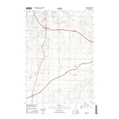
2016 Map of Simpson
USGS Topo · Published 2016About this map
The southern outskirts of Rochester and the surrounding rural townships of Olmsted County are defined by a mix of aviation infrastructure and historic rural burial grounds. The sprawling Rochester International Airport dominates the southwestern quadrant, while to the north, the neighborhood of Golden Hill and the campus of Crossroads Coll mark the transition from city to country. The landscape is drained by several small watercourses, including Willow Cr and Bear Cr, which eventually give way to the more prominent North Branch Root River as it winds through the southern portion of the sheet. Settled areas like Simpson and Judge maintain their identity as small crossroads within this agricultural landscape. Local history and genealogy are anchored by several sites, notably Saint Bridget Cem, Fairview Cem, and Jerusalem Cem, which sit alongside the county road network that grids the rolling Minnesota terrain.
Find a feature on this map
136 named features on this map. Tap any name to fly to it.
Don’t see what you’re looking for? This feature index may not catch every label — zoom into the map to look around manually.
Map Details
Editions of this 2016 Simpson Map
This is the sole edition of this map. No revisions or reprints were ever made.
Other maps of this area

1935 · Rochester
USGS Topo · 1:48,000

1939 · Rochester
USGS Topo · 1:62,500

1953 · Saint Paul
USGS Topo · 1:250,000

1954 · Mason City
USGS Topo · 1:250,000

1955 · Stewartville
USGS Topo · 1:62,500

1955 · High Forest
USGS Topo · 1:62,500

1957 · Mason City
USGS Topo · 1:250,000

1958 · Mason City
USGS Topo · 1:250,000

1959 · Saint Paul
USGS Topo · 1:250,000

1966 · Douglas
USGS Topo · 1:24,000