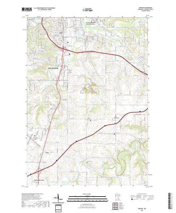
2022 Map of Simpson
USGS Topo · Published 2022About this map
Rochester expands southward in this recent survey of Olmsted County, where urban development meets the agricultural reaches of the N Br Root River and Whitney Cr watersheds. The map details the significant footprint of the Rochester International Airport in the southwest, anchoring the local transportation infrastructure alongside major routes like Marion Rd SE. Historically significant sites for genealogists include Saint Bridget Cem, Fairview Cem, and Jerusalem Cem, which mark earlier community centers near the hamlets of Simpson and Judge. The landscape is defined by the transition from the city's residential streets, such as those around Golden Hill, to the wooded drainages of Willow Cr and Badger Run, revealing how modern suburban growth navigates the established hydrological network of southeastern Minnesota.
Find a feature on this map
141 named features on this map. Tap any name to fly to it.
Don’t see what you’re looking for? This feature index may not catch every label — zoom into the map to look around manually.
Map Details
Editions of this 2022 Simpson Map
This is the sole edition of this map. No revisions or reprints were ever made.
Other maps of this area

1935 · Rochester
USGS Topo · 1:48,000

1939 · Rochester
USGS Topo · 1:62,500

1953 · Saint Paul
USGS Topo · 1:250,000

1954 · Mason City
USGS Topo · 1:250,000

1955 · Stewartville
USGS Topo · 1:62,500

1955 · High Forest
USGS Topo · 1:62,500

1957 · Mason City
USGS Topo · 1:250,000

1958 · Mason City
USGS Topo · 1:250,000

1959 · Saint Paul
USGS Topo · 1:250,000

1966 · Douglas
USGS Topo · 1:24,000