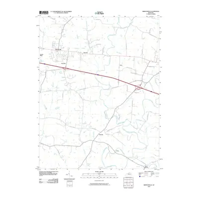
2010 Map of Simpsonville
USGS Topo · Published 2010About this map
The agrarian landscape of Shelby County is defined here by the headwaters of several prominent waterways, including Bullskin Creek and its tributary Little Bullskin Creek. Central to this area is Simpsonville, a historic settlement that sits along a major transportation corridor, flanked by smaller communities such as Montclair and Veechdale. Further south, Finchville marks a crossroads near the winding path of Brashears Creek, where the local landscape begins to show the density of small rural homesteads and family farms typical of this portion of the Kentucky Bluegrass region.
Find a feature on this map
46 named features on this map. Tap any name to fly to it.
Don’t see what you’re looking for? This feature index may not catch every label — zoom into the map to look around manually.
Map Details
Editions of this 2010 Simpsonville Map
This is the sole edition of this map. No revisions or reprints were ever made.
Other maps of this area

1923 · Waddy
USGS Topo · 1:48,000

1925 · Mount Eden
USGS Topo · 1:48,000

1927 · Mount Eden
USGS Topo · 1:62,500

1928 · New Castle
USGS Topo · 1:48,000

1929 · Taylorsville
USGS Topo · 1:62,500

1932 · New Castle
USGS Topo · 1:62,500

1932 · La Grange
USGS Topo · 1:62,500

1951 · Crestwood
USGS Topo · 1:24,000

1951 · Fisherville
USGS Topo · 1:24,000

1951 · Waterford
USGS Topo · 1:24,000