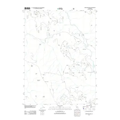
2012 Map of Sims Mountain
USGS Topo · Published 2012About this map
Sims Mountain and the high ridges of Humboldt County define this landscape of the Six Rivers region during the early 21st century. The S Fork Trinity River winds through the eastern portion of the sheet, crossed only by the remote Mule Bridge near the Manzanita Ranch. Settlement patterns here are dominated by isolated outposts and seasonal sites, including the Lake Mountain Ranch, Hog Ranch, and the Dan East Cabin.
Find a feature on this map
84 named features on this map. Tap any name to fly to it.
Don’t see what you’re looking for? This feature index may not catch every label — zoom into the map to look around manually.
Map Details
Editions of this 2012 Sims Mountain Map
This is the sole edition of this map. No revisions or reprints were ever made.
Other maps of this area

1909 · Big Bar
USGS Topo · 1:96,000

1914 · Pilot Creek
USGS Topo · 1:62,500

1915 · Big Bar and Vicinity
USGS Topo · 1:250,000

1922 · China Flat
USGS Topo · 1:62,500

1951 · Pilot Creek
USGS Topo · 1:62,500

1951 · Hyampom
USGS Topo · 1:62,500

1951 · Ironside Mountain
USGS Topo · 1:62,500

1952 · Willow Creek
USGS Topo · 1:62,500

1958 · Redding
USGS Topo · 1:250,000
1977 · Board Camp Mtn
USGS Topo · 1:24,000