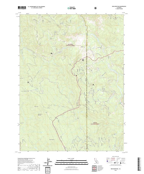
2022 Map of Sims Mountain
USGS Topo · Published 2022About this map
The Trinity Wild and Scenic River and its tributary, the South Fork Trinity River, define the eastern landscape of this quadrangle at the intersection of the Six Rivers National Forest and Trinity National Forest. The topography is marked by prominent elevations such as Sims Mtn and Potato Hill, while the Humboldt and Trinity County line bisects the area. Local naming conventions are evident in features like Waterbarrel Opening, Smith Opening, and Mule Spring, reflecting the historical utility of the land for cattle or forestry.
Find a feature on this map
48 named features on this map. Tap any name to fly to it.
Don’t see what you’re looking for? This feature index may not catch every label — zoom into the map to look around manually.
Map Details
Editions of this 2022 Sims Mountain Map
This is the sole edition of this map. No revisions or reprints were ever made.
Other maps of this area

1909 · Big Bar
USGS Topo · 1:96,000

1914 · Pilot Creek
USGS Topo · 1:62,500

1915 · Big Bar and Vicinity
USGS Topo · 1:250,000

1922 · China Flat
USGS Topo · 1:62,500

1951 · Pilot Creek
USGS Topo · 1:62,500

1951 · Hyampom
USGS Topo · 1:62,500

1951 · Ironside Mountain
USGS Topo · 1:62,500

1952 · Willow Creek
USGS Topo · 1:62,500

1958 · Redding
USGS Topo · 1:250,000
1977 · Board Camp Mtn
USGS Topo · 1:24,000