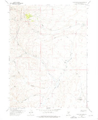
1958 Map of Singletree Creek
USGS Topo · Published 1976About this map
Independence Mountains and Lone Mountain dominate this Elko County landscape, where mineral extraction left a heavy footprint by the mid-1950s. The northern reaches show concentrated activity at the Rip Van Winkle Mine and a nearby Open Pit Mine, supported by numerous Shafts and Tunnels cut into the slopes. This mineral interest is balanced by high-country ranching infrastructure, evidenced by Sproule Cabin and the Green Cabin situated near Green Cabin Meadows.
Find a feature on this map
26 named features on this map. Tap any name to fly to it.
Don’t see what you’re looking for? This feature index may not catch every label — zoom into the map to look around manually.
Map Details
Editions of this 1958 Singletree Creek Map
2 editions found
Other maps of this area

1955 · McDermitt
USGS Topo · 1:250,000

1955 · Wells
USGS Topo · 1:250,000

1955 · Winnemucca
USGS Topo · 1:250,000

1955 · Elko
USGS Topo · 1:250,000

1958 · Winnemucca
USGS Topo · 1:250,000

1958 · Wells
USGS Topo · 1:250,000

1958 · Elko
USGS Topo · 1:250,000

1958 · Singletree Creek
USGS Topo · 1:24,000

1958 · Blue Basin
USGS Topo · 1:24,000

1958 · Doby Summit
USGS Topo · 1:24,000