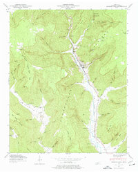
1947 Map of Sinking Cove
USGS Topo · Published 1977About this map
Sherwood and Tantallon are the primary hubs of activity in this 1947 study, positioned where the Nashville Chattanooga and St Louis railway winds through the deep corridor of Crow Creek. The terrain is characterized by the massive dissected finger of the Cumberland Plateau, where numerous steep hollows like Tom Pack Hollow and Pumplog Hollow drain toward the central valley.
Find a feature on this map
54 named features on this map. Tap any name to fly to it.
Don’t see what you’re looking for? This feature index may not catch every label — zoom into the map to look around manually.
Map Details
Editions of this 1947 Sinking Cove Map
3 editions found
Other maps of this area

1886 · Stevenson
USGS Topo · 1:125,000

1888 · Scottsboro
USGS Topo · 1:125,000

1892 · Scottsboro
USGS Topo · 1:125,000

1892 · Stevenson
USGS Topo · 1:125,000

1895 · Stevenson
USGS Topo · 1:125,000

1895 · Sewanee
USGS Topo · 1:125,000

1928 · Decherd
USGS Topo · 1:62,500

1936 · Sewanee
USGS Topo · 1:24,000

1936 · Orme
USGS Topo · 1:24,000

1936 · Sinking Cove
USGS Topo · 1:24,000