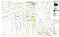
1986 Map of Sioux City South
USGS Topo · Published 1986About this map
The Missouri River valley serves as the central axis for this mid-1980s map, marking the convergence of Iowa, Nebraska, and South Dakota. In Nebraska, the landscape is defined by the large contiguous territories of the Winnebago Indian Reservation and the Omaha Indian Reservation, which dominate the southern half of the sheet. Industrial and civic development is concentrated at the northern bend, where South Sioux City and Dakota City sit opposite the Iowa side's urban expansion.
Find a feature on this map
110 named features on this map. Tap any name to fly to it.
Don’t see what you’re looking for? This feature index may not catch every label — zoom into the map to look around manually.
Map Details
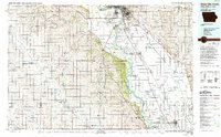
Editions of this 1986 Sioux City South Map
2 editions found
Other maps of this area

1898 · Elk Point
USGS Topo · 1:125,000

1901 · Elk Point
USGS Topo · 1:125,000

1907 · Elk Point
USGS Topo · 1:125,000

1954 · Omaha
USGS Topo · 1:250,000

1954 · Fort Dodge
USGS Topo · 1:250,000

1955 · Sioux City
USGS Topo · 1:250,000

1955 · Fremont
USGS Topo · 1:250,000

1957 · Fremont
USGS Topo · 1:250,000

1957 · Omaha
USGS Topo · 1:250,000

1957 · Fort Dodge
USGS Topo · 1:250,000