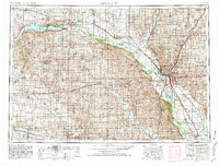
1955 Map of Sioux City
USGS Topo · Published 1981About this map
The Missouri River forms the central artery of this mid-century landscape, defining the borders between South Dakota, Nebraska, and Iowa. At the northwestern bend, the massive Gavins Point Dam and its Spillway create the expansive Lewis and Clark Lake, a significant modification to the river's natural course. The map documents the complex cultural geography of the region, showing the contiguous boundaries of the Santee Indian Reservation, Winnebago Indian Reservation, and Omaha Indian Reservation.
Find a feature on this map
87 named features on this map. Tap any name to fly to it.
Don’t see what you’re looking for? This feature index may not catch every label — zoom into the map to look around manually.
Map Details
Editions of this 1955 Sioux City Map
4 editions found

Other maps of this area

1897 · Canton
USGS Topo · 1:125,000

1898 · Olivet
USGS Topo · 1:125,000

1898 · Parker
USGS Topo · 1:125,000

1898 · Elk Point
USGS Topo · 1:125,000

1900 · Canton
USGS Topo · 1:125,000

1901 · Elk Point
USGS Topo · 1:125,000

1907 · Elk Point
USGS Topo · 1:125,000

1950 · Niobrara
USGS Topo · 1:24,000

1950 · Verdigre NE
USGS Topo · 1:24,000

1954 · Verdigre
USGS Topo · 1:24,000