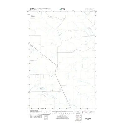
2011 Map of Sioux Pass
USGS Topo · Published 2011About this map
Sioux Pass serves as the central point of this Richland County landscape, where the high plains are carved by several seasonal drainages and local water management infrastructure. The map reveals a rural community structured around cattle ranching and dryland farming, evidenced by the numerous small-scale earthen works such as Peterson Dam, A Peterson Dam, and Leo Dam that capture runoff for livestock. Genealogists can find local burial records at Saint Peters Cemetery, located along the southern corridor near the North Fork First Hay Creek. The area is defined by its rectilinear road system, including County Rd 342 and County Rd 142, which connect isolated homesteads to the main pass. In the northern reaches, larger water features like the C Sowle Reservoir Number 2 Dam and Otis Creek highlight the vital importance of water rights and management in this semi-arid region of eastern Montana.
Find a feature on this map
18 named features on this map. Tap any name to fly to it.
Don’t see what you’re looking for? This feature index may not catch every label — zoom into the map to look around manually.
Map Details
Editions of this 2011 Sioux Pass Map
This is the sole edition of this map. No revisions or reprints were ever made.
Other maps of this area

1909 · Glendive
USGS Topo · 1:250,000

1954 · Glendive
USGS Topo · 1:250,000

1954 · Wolf Point
USGS Topo · 1:250,000

1957 · Glendive
USGS Topo · 1:250,000

1958 · Wolf Point
USGS Topo · 1:250,000

1958 · Glendive
USGS Topo · 1:250,000

1969 · Cedar Coulee
USGS Topo · 1:24,000

1969 · Three Buttes
USGS Topo · 1:24,000

1969 · Bainville SW
USGS Topo · 1:24,000

1972 · Brorson
USGS Topo · 1:24,000