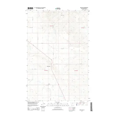
2014 Map of Sioux Pass
USGS Topo · Published 2014About this map
Sioux Pass sits at the heart of this Richland County landscape, where the high plains of eastern Montana are carved by a network of seasonal drainages and coulees. The terrain is defined by the winding paths of N Fork First Hay Cr and Otis Cr, illustrating the complex topography of the region. A notable point of local historical interest is Saint Peters Cem, located south of the main settlement area near the intersection of Co Road 138 and Co Road 342. The map details the rural infrastructure of the early 21st century, showing how Mt-16 serves as a primary corridor through the area, linking scattered farmsteads and agricultural plots. The inclusion of features like Wells Coulee and S Fork Cherry Cr provides a clear picture of the natural drainage patterns that have long influenced settlement and land use in this part of the state.
Find a feature on this map
18 named features on this map. Tap any name to fly to it.
Don’t see what you’re looking for? This feature index may not catch every label — zoom into the map to look around manually.
Map Details
Editions of this 2014 Sioux Pass Map
This is the sole edition of this map. No revisions or reprints were ever made.
Other maps of this area

1909 · Glendive
USGS Topo · 1:250,000

1954 · Glendive
USGS Topo · 1:250,000

1954 · Wolf Point
USGS Topo · 1:250,000

1957 · Glendive
USGS Topo · 1:250,000

1958 · Wolf Point
USGS Topo · 1:250,000

1958 · Glendive
USGS Topo · 1:250,000

1969 · Cedar Coulee
USGS Topo · 1:24,000

1969 · Three Buttes
USGS Topo · 1:24,000

1969 · Bainville SW
USGS Topo · 1:24,000

1972 · Brorson
USGS Topo · 1:24,000