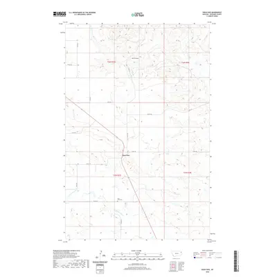
2020 Map of Sioux Pass
USGS Topo · Published 2020About this map
Sioux Pass occupies a central position in this Richland County landscape, where the high plains are carved by a network of seasonal drainages and coulees. The map traces the winding paths of N Fork First Hay Cr and S Fork Cherry Cr, reflecting a terrain where water sources dictate the placement of rural infrastructure. Located south of the main settlement, Saint Peters Cem serves as a significant landmark for genealogical research and local history, situated near the intersection of Co Rd 138 and Co Rd 342. The grid of county roads, including Co Rd 140 and Co Rd 142, provides a clear view of the modern land divisions and access points across the northern Montana prairie.
Find a feature on this map
16 named features on this map. Tap any name to fly to it.
Don’t see what you’re looking for? This feature index may not catch every label — zoom into the map to look around manually.
Map Details
Editions of this 2020 Sioux Pass Map
This is the sole edition of this map. No revisions or reprints were ever made.
Other maps of this area

1909 · Glendive
USGS Topo · 1:250,000

1954 · Glendive
USGS Topo · 1:250,000

1954 · Wolf Point
USGS Topo · 1:250,000

1957 · Glendive
USGS Topo · 1:250,000

1958 · Wolf Point
USGS Topo · 1:250,000

1958 · Glendive
USGS Topo · 1:250,000

1969 · Cedar Coulee
USGS Topo · 1:24,000

1969 · Three Buttes
USGS Topo · 1:24,000

1969 · Bainville SW
USGS Topo · 1:24,000

1972 · Brorson
USGS Topo · 1:24,000