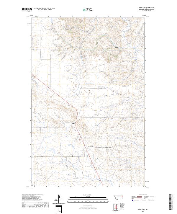
2024 Map of Sioux Pass
USGS Topo · Published 2024About this map
Sioux Pass serves as the central focal point of this Eastern Montana landscape, where the high plains are carved by a network of drainage coulees and seasonal creeks. The terrain is defined by the winding paths of Wells Coulee and Otis Creek, which slice through the rolling uplands. This area of Richland County remains characterized by its rural agricultural layout, evident in the organized grid of county roads such as Co RD 341 and Co RD 142 that segment the townships of T26N R57E and T25N R57E.
Find a feature on this map
17 named features on this map. Tap any name to fly to it.
Don’t see what you’re looking for? This feature index may not catch every label — zoom into the map to look around manually.
Map Details
Editions of this 2024 Sioux Pass Map
This is the sole edition of this map. No revisions or reprints were ever made.
Other maps of this area

1909 · Glendive
USGS Topo · 1:250,000

1954 · Glendive
USGS Topo · 1:250,000

1954 · Wolf Point
USGS Topo · 1:250,000

1957 · Glendive
USGS Topo · 1:250,000

1958 · Wolf Point
USGS Topo · 1:250,000

1958 · Glendive
USGS Topo · 1:250,000

1969 · Cedar Coulee
USGS Topo · 1:24,000

1969 · Three Buttes
USGS Topo · 1:24,000

1969 · Bainville SW
USGS Topo · 1:24,000

1972 · Brorson
USGS Topo · 1:24,000