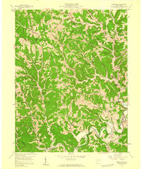
1958 Map of Sissonville
USGS Topo · Published 1959About this map
The Pocatalico River winds through this 1958 topographic landscape, defining the character of northern Kanawha County at a time when the region was a dense network of hollows and ridges. Small rural communities like Sissonville and Goldtown serve as focal points for a scattered population connected by winding roads and numerous family-named landmarks. The map reveals a deeply social landscape, with civic life anchored by institutions such as the Point Harmony Sch, Betty L Sch, and several houses of worship including Allens Chapel, Bonham Chapel, and Oak Grove Ch.
Find a feature on this map
93 named features on this map. Tap any name to fly to it.
Don’t see what you’re looking for? This feature index may not catch every label — zoom into the map to look around manually.
Map Details
Editions of this 1958 Sissonville Map
4 editions found
Other maps of this area

1899 · Charleston
USGS Topo · 1:125,000

1906 · Kenna
USGS Topo · 1:62,500

1906 · Winfield
USGS Topo · 1:62,500

1907 · Kenna
USGS Topo · 1:62,500

1908 · Winfield
USGS Topo · 1:62,500

1909 · Charleston
USGS Topo · 1:62,500

1909 · Saint Albans
USGS Topo · 1:62,500

1931 · Saint Albans
USGS Topo · 1:62,500

1931 · Charleston
USGS Topo · 1:62,500

1933 · Saint Albans
USGS Topo · 1:62,500