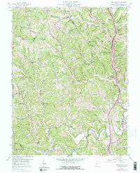
1958 Map of Sissonville
USGS Topo · Published 1976About this map
The Pocatalico River meanders through a landscape defined by steep ridges and narrow hollows during the mid-20th century. This area, spanning the borders of Putnam, Jackson, and Kanawha counties, shows a dispersed rural settlement pattern typical of the West Virginia hills. Small communities and family landmarks are scattered throughout, including Liberty, Allens Chapel, and Cavelick. The map reveals a high density of local educational and religious institutions, such as Unexpected School, Betty L School, and the uniquely named Guiding Light Ch.
Find a feature on this map
101 named features on this map. Tap any name to fly to it.
Don’t see what you’re looking for? This feature index may not catch every label — zoom into the map to look around manually.
Map Details
Editions of this 1958 Sissonville Map
4 editions found
Other maps of this area

1899 · Charleston
USGS Topo · 1:125,000

1906 · Kenna
USGS Topo · 1:62,500

1906 · Winfield
USGS Topo · 1:62,500

1907 · Kenna
USGS Topo · 1:62,500

1908 · Winfield
USGS Topo · 1:62,500

1909 · Charleston
USGS Topo · 1:62,500

1909 · Saint Albans
USGS Topo · 1:62,500

1931 · Saint Albans
USGS Topo · 1:62,500

1931 · Charleston
USGS Topo · 1:62,500

1933 · Saint Albans
USGS Topo · 1:62,500