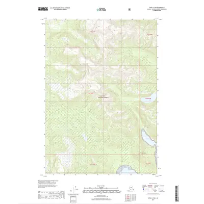
2017 Map of Sitka A-2 NE
USGS Topo · Published 2017About this map
Tongass National Forest covers this expansive coastal landscape in the Alexander Archipelago, showing the intricate geography of the region as it was surveyed in 2017. The map focuses on the steep, wooded terrain defined by Mt Saffran, which rises sharply between the tidal waters of the coast and interior lakes. Large bodies of water characterize the eastern and southern edges of the sheet, notably Chapin Bay and the mouth of Herring Bay. Small, isolated freshwater features like Eliza Lake sit high in the drainage basins, illustrating the complex watershed typical of this part of Alaska. While no permanent settlements are shown, the presence of various township and range boundaries such as t54s r69e and t55s r70e provides a precise grid for land navigation and topographical study.
Find a feature on this map
11 named features on this map. Tap any name to fly to it.
Don’t see what you’re looking for? This feature index may not catch every label — zoom into the map to look around manually.
Map Details
Editions of this 2017 Sitka A-2 NE Map
This is the sole edition of this map. No revisions or reprints were ever made.
Other maps of this area

1948 · Sitka B-1
USGS Topo · 1:63,360

1948 · Sitka A-2
USGS Topo · 1:63,360

1948 · Sitka B-2
USGS Topo · 1:63,360

1948 · Sitka A-1
USGS Topo · 1:63,360

1951 · Sitka
USGS Topo · 1:250,000

1951 · Sitka A-2
USGS Topo · 1:63,360

1951 · Sitka B-2
USGS Topo · 1:63,360

1951 · Sitka B-1
USGS Topo · 1:63,360

1952 · Sitka
USGS Topo · 1:250,000

1964 · Sitka
USGS Topo · 1:250,000