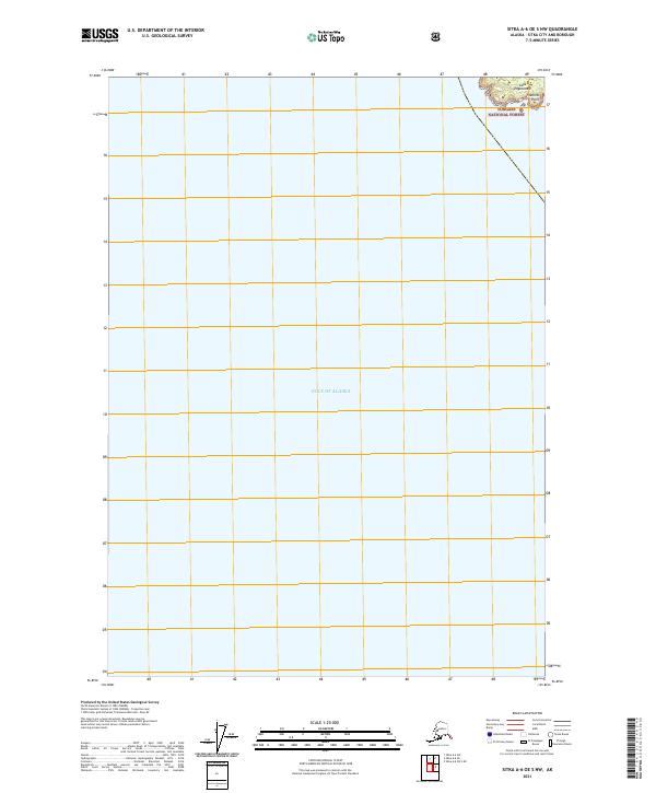
2021 Map of Sitka A-6 OE S NW
USGS Topo · Published 2021About this map
The Gulf of Alaska dominates this coastal landscape on the edge of the Tongass National Forest. Located in the Sitka City and Borough, the map highlights the rugged maritime interface where the Pacific meets the Alaskan wilderness. Dramatic topographical features at the water's edge include Cape Edgecumbe and Trubitsin Point, which serve as critical navigation landmarks for this portion of the coastline. The vast majority of the sheet is dedicated to the open water of the gulf, providing a clear view of the bathymetry and the shoreline's boundary within the forest service jurisdiction.
Find a feature on this map
5 named features on this map. Tap any name to fly to it.
Don’t see what you’re looking for? This feature index may not catch every label — zoom into the map to look around manually.
Map Details
Editions of this 2021 Sitka A-6 OE S NW Map
This is the sole edition of this map. No revisions or reprints were ever made.
Other maps of this area

1951 · Sitka A-6
USGS Topo · 1:63,360

1951 · Sitka
USGS Topo · 1:250,000

1951 · Port Alexander
USGS Topo · 1:250,000

1952 · Port Alexander
USGS Topo · 1:250,000

1952 · Sitka
USGS Topo · 1:250,000

1964 · Sitka
USGS Topo · 1:250,000

1964 · Port Alexander
USGS Topo · 1:250,000
2017 · Sitka A-6 OE S NW
USGS Topo · 1:25,000
2017 · Sitka A-6 OE S NE
USGS Topo · 1:25,000
2017 · Sitka A-6 SW
USGS Topo · 1:25,000