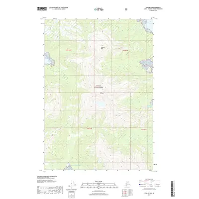
2017 Map of Sitka B-1 SW
USGS Topo · Published 2017About this map
Tongass National Forest dominates this coastal landscape in the Alexander Archipelago, showing a wilderness largely untouched by development in the early 21st century. The map depicts the dramatic transition from the open waters of the Gulf of Alaska to the steep, wooded slopes of the inland terrain. Notable peaks such as Soapberry Mtn and Bear Pass Mtn define the interior, while the shoreline is broken by the deep indentation of the South Arm Hood Bay. This survey emphasizes the high-relief topography characteristic of Southeast Alaska, where glacial valleys and saltwater inlets meet. The absence of roads or permanent settlements highlights the protected status of the national forest and the preservation of this coastal ecosystem as it remained nearly a decade after the turn of the millennium.
Find a feature on this map
9 named features on this map. Tap any name to fly to it.
Don’t see what you’re looking for? This feature index may not catch every label — zoom into the map to look around manually.
Map Details
Editions of this 2017 Sitka B-1 SW Map
This is the sole edition of this map. No revisions or reprints were ever made.
Other maps of this area

1948 · Sitka B-1
USGS Topo · 1:63,360

1948 · Sitka A-2
USGS Topo · 1:63,360

1948 · Sitka B-2
USGS Topo · 1:63,360

1948 · Sitka A-1
USGS Topo · 1:63,360

1951 · Sitka
USGS Topo · 1:250,000

1951 · Sitka A-2
USGS Topo · 1:63,360

1951 · Sitka B-2
USGS Topo · 1:63,360

1951 · Sitka B-1
USGS Topo · 1:63,360

1952 · Sitka
USGS Topo · 1:250,000

1964 · Sitka
USGS Topo · 1:250,000