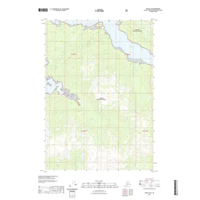
2021 Map of Sitka B-2 SE
USGS Topo · Published 2021About this map
South Arm Hood Bay carves into the mountainous interior of Admiralty Island, serving as the primary maritime feature of this coastal wilderness. The landscape is entirely encompassed within the Tongass National Forest, where steep, timbered slopes rise sharply from the waterline. This 2021 survey illustrates a remote portion of the Hoonah-Angoon area, dominated by high-elevation contours and the intricate shoreline of the South Arm. While largely devoid of permanent human infrastructure, the area is defined by its complex hydrography and the dense topography of the Alexander Archipelago, which has historically supported seasonal fishing and timber interests throughout the unorganized borough.
Find a feature on this map
7 named features on this map. Tap any name to fly to it.
Don’t see what you’re looking for? This feature index may not catch every label — zoom into the map to look around manually.
Map Details
Editions of this 2021 Sitka B-2 SE Map
This is the sole edition of this map. No revisions or reprints were ever made.
Other maps of this area

1948 · Sitka B-1
USGS Topo · 1:63,360

1948 · Sitka A-2
USGS Topo · 1:63,360

1948 · Sitka B-2
USGS Topo · 1:63,360

1948 · Sitka A-1
USGS Topo · 1:63,360

1951 · Sitka
USGS Topo · 1:250,000

1951 · Sitka A-2
USGS Topo · 1:63,360

1951 · Sitka B-2
USGS Topo · 1:63,360

1951 · Sitka B-1
USGS Topo · 1:63,360

1952 · Sitka
USGS Topo · 1:250,000

1964 · Sitka
USGS Topo · 1:250,000