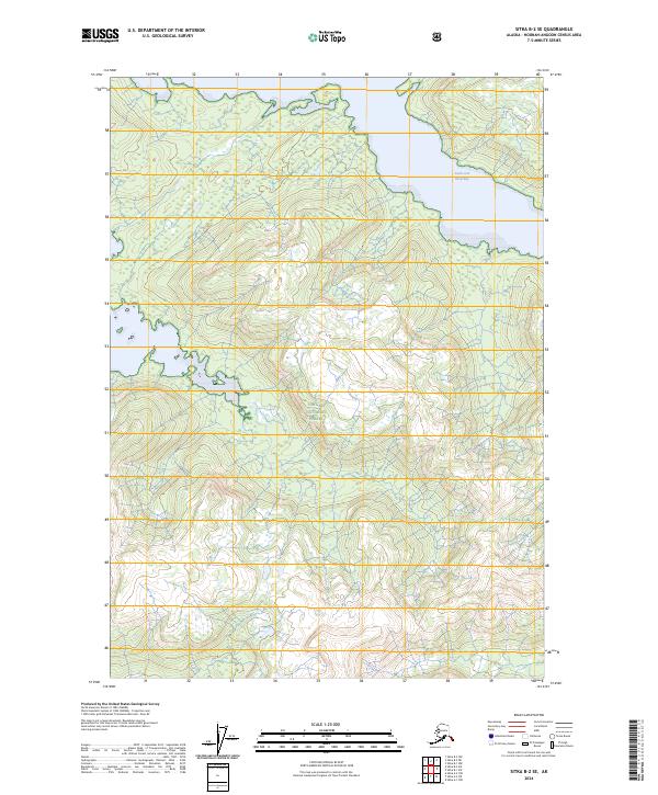
2024 Map of Sitka B-2 SE
USGS Topo · Published 2024About this map
Admiralty Island dominates this 2024 survey, showcasing a landscape defined by expansive protected wilderness and coastal inlets. The terrain is primarily managed within the Tongass National Forest and the Admiralty Island National Monument, reflecting the region's long-standing status as a preserved ecosystem. The northeastern corner of the map is punctuated by the South Arm Hood Bay, a significant water body that penetrates the interior of the island. Within these federal lands, the Kootznoowoo Wilderness represents a specialized designation, preserving the traditional lands of the Tlingit people and maintaining the island's character as a place of extreme ecological importance. The map's contour lines and boundary markings delineate the complex relationship between maritime accessibility and the high, inland forest areas that characterize the Hoonah-Angoon Census Area.
Find a feature on this map
9 named features on this map. Tap any name to fly to it.
Don’t see what you’re looking for? This feature index may not catch every label — zoom into the map to look around manually.
Map Details
Editions of this 2024 Sitka B-2 SE Map
This is the sole edition of this map. No revisions or reprints were ever made.
Other maps of this area

1948 · Sitka B-1
USGS Topo · 1:63,360

1948 · Sitka A-2
USGS Topo · 1:63,360

1948 · Sitka B-2
USGS Topo · 1:63,360

1948 · Sitka A-1
USGS Topo · 1:63,360

1951 · Sitka
USGS Topo · 1:250,000

1951 · Sitka A-2
USGS Topo · 1:63,360

1951 · Sitka B-2
USGS Topo · 1:63,360

1951 · Sitka B-1
USGS Topo · 1:63,360

1952 · Sitka
USGS Topo · 1:250,000

1964 · Sitka
USGS Topo · 1:250,000